Course Standards
14-3. Set Up a Land Navigation Course
The unit commander provides specific guidance on what he requires in the development of a land navigation course. It depends upon the unit's mission, training plan, and tasks to be trained. There are basic guidelines to use when setting up a course.
Determind the Standards
The unit commander determines the standards for the course. Recommended standards are as follows:
- Distance between points: no less than 300 meters; no more than 1,200 meters.
- Total distance of lanes: no less than 2,700 meters; no more than 11,000 meters.
- Total number of position stakes: no less than seven for each lane; no more than nine for each lane.
- Time allowed: no less than three hours; no more than four hours.
REF: FM 3-25.26, Land Navigation, Dtd. 2005
Land Navigation Course
- 10 Lanes
- WHFRTC Maps are 1:25,000 Scale, Provides Best Resolution and Work With Any Military Protractor
- Total Distance Between Points: No Less Than 300m – No More Than 1200m. Each Lane has (1) 1000m “leg.”
- Total Distance of Each Lane: Avg. 4200m, Difference Between Lanes – No More Than 300m.
- Total Number of Position Stakes per Lane: No Less Than Seven – No More Than Nine. Each Lane has 7 Position Stakes or “Legs.” Start Point and End Point Same on Each Lane.
- Time Duration: Course Completed in No More Than 4 Hours.
- Soldier Receives a “GO” with all correct punch marker symbols attained within no-more-than (4) Hours.
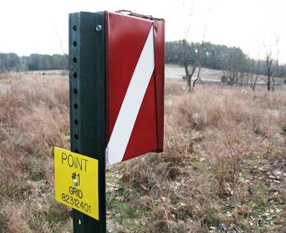
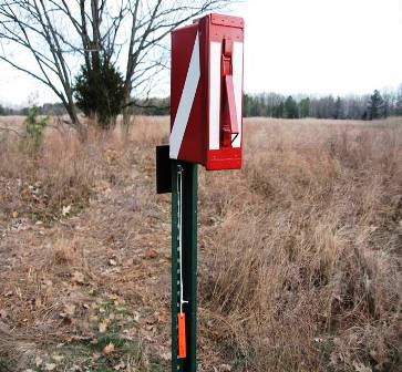
Point Markers
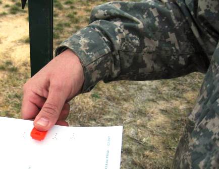
Punch Markers
A punch marker is located at each point to mark the student’s score sheet.
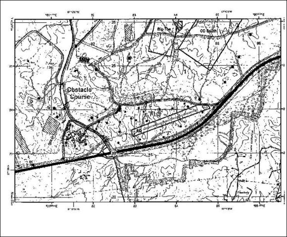
Land Navigation and Orienteering Course Map (Sample)
WHFRTC Provides: Student Maps, Student Course/Score Sheets and master Key for Graders
Unit Provides: Military Protractors and Compasses